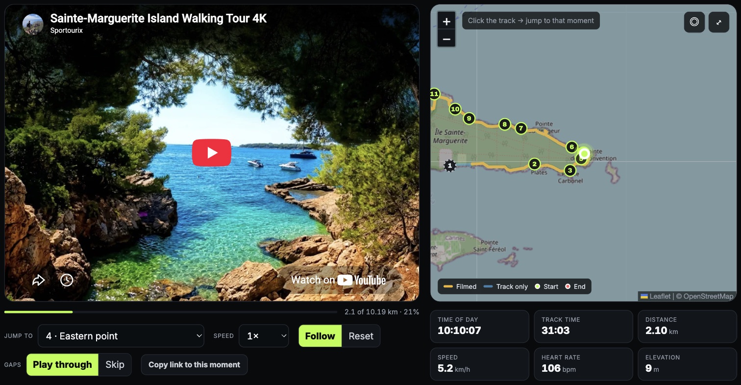
Maps tell you where a route goes. They do not tell you what it feels like. Sportourix puts the whole tour, filmed in one take, next to the GPS track recorded at the same moment — and finds the places worth stopping at along it.
What a tour page is
video and map on one clock
123
1 The video, one continuous take2 The map: the track, the filmed part of it, and where you are right now3 Speed, heart rate, elevation and distance at that very second
Scrub the video the dot walks the map with it.
Drag the dot the video jumps to that spot.
Read as you go speed, heart rate, height, distance covered.
How a tour is made
from two recordings to one page
01
activity.fit0067.MP40068.MP4+2
Tour
Name it, pick its type and the timezone it happened in, and drop the GPS track (.gpx or .fit) with every video file — it all goes up in one go.
02
Preparing footage
The files are joined end to end into one reel for watching, and into a frame stream — two sharp pictures a second — that every picture of the tour comes from.
03
Timeline
Each piece lands on the GPS clock at the time it was filmed. Watch it play beside the map, drag a piece, cut it, mark a stretch without GPS, then confirm.
04
Processing
Places worth stopping at are found along the route on OpenStreetMap; the frames around each are looked at, and titles and descriptions are written from the map facts.
05
Results
Edit, hide or add points, pick the best frame, link the published video on YouTube — and embed the tour on any page as a widget.
Two recorders run side by side. The watch never stops; the camera does — it fills a file, starts another, and sometimes it is simply switched off. A shared clock is what puts the two back together.
09:4010:1210:4511:1711:50
Watch
Camera
006709:49006810:22006910:54007011:34camera off
same second
heart rate, speed, position — every second a video file, placed at its recording time not filmed — the map keeps moving
Every clip remembers when it started. The camera stamps the file; the timeline reads that stamp and puts the clip on the track at that moment — or lets you place it by hand when there is none.
The stamp is the only link needed. Any moment on screen maps to a moment on the watch, and any point on the map maps back to a frame.
Breaks stay breaks. Where nothing was filmed, the map keeps moving and the player steps aside — nothing is stretched to cover the hole.
What you need
what records what
Track
A GPS watch or phone
.gpx or .fit
1 reading per second is ideal
heart rate, elevation, speed
Camera
Any action camera
working copies up to 1080p
4 GB per file
keep the recording time
Publishing
YouTube
the same reel in 4K
one offset to line it up
plays in the widget
About the numbers
Distance, elevation and heart rate come from the watch, untouched. Ascent is smoothed over a short window before it is summed, because a barometer left raw inflates the total by counting its own noise. Average speed is computed over moving time only, so standing still does not drag it toward zero.
The camera clock is the single assumption in the chain: each file's recording time is read from its metadata and taken in the tour's timezone. When a clock was set wrong, the pieces are simply moved on the timeline — nothing has to be re-encoded.
Try it
The quickest way to understand it is to make a tour and drag the dot.